Thirty years ago, on the night of October 4th, 1994, the Southern Kuril Islands were struck by one of the most powerful tsunamigenic earthquakes in their history. The event, which registered as a magnitude 8.2, not only shook the very foundations of the islands but also sent a devastating tsunami crashing onto their shores. Now, a comprehensive review published in the journal *Геосистемы переходных зон* (Transitional Zone Geosystems) by Victor M. Kaistrenko of the Institute of Marine Geology and Geophysics of the Far Eastern Branch of the Russian Academy of Sciences, offers a fresh look at the event and its lasting impacts.
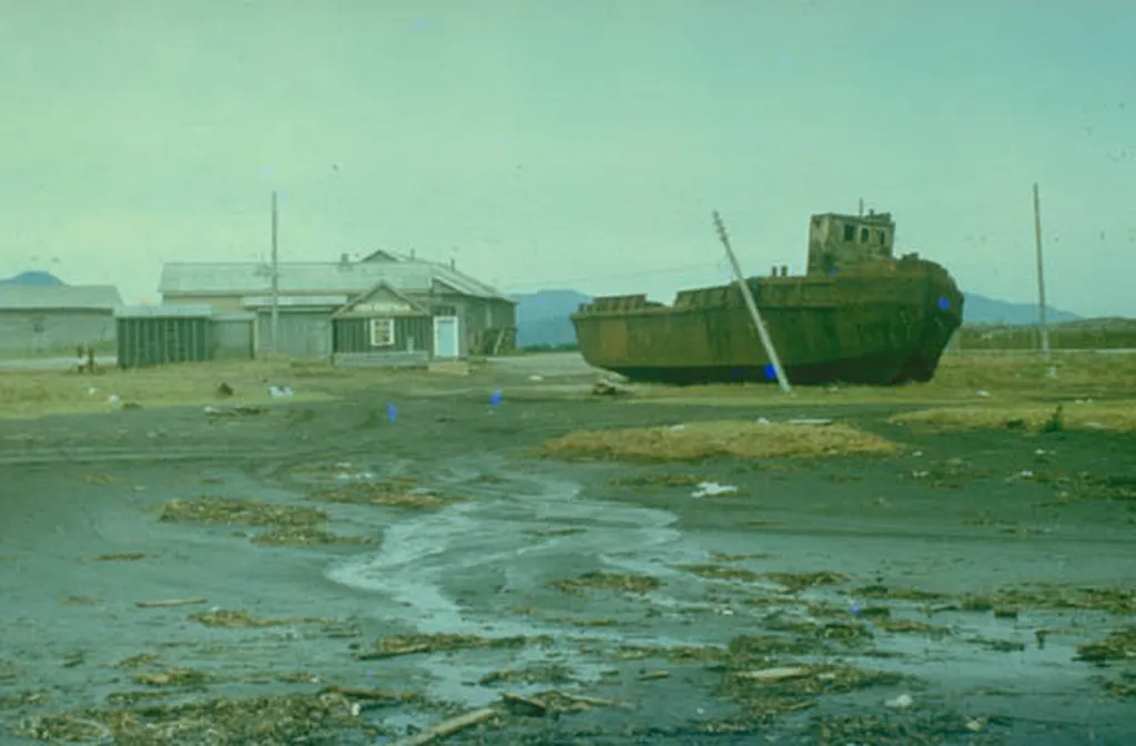
The earthquake and subsequent tsunami caused widespread destruction, with the entire infrastructure on Shikotan and Kunashir Islands collapsing. “Intense shaking led to the collapse of buildings, roads, and communication lines,” Kaistrenko explains. “The tsunami that followed reached heights of about 10 meters on the ocean side of Shikotan Island and was recorded along the entire coast of the Pacific Ocean.” The disaster claimed 11 lives and left an indelible mark on the region.
Kaistrenko’s review, which synthesizes data collected between 1994 and 1997, also delves into the lesser-known phenomena that accompanied the earthquake, such as seaquakes—specific effects on the ocean surface. “For the first time, we’ve collected and systematized data on these phenomena,” Kaistrenko notes. This information is crucial for understanding the complex interplay between tectonic activity and ocean dynamics.
The study also highlights the importance of examining the deposits left behind by the 1994 tsunami in the broader context of ancient tsunami, or paleotsunami, deposits. By studying these traces, researchers can gain insights into the frequency and magnitude of past events, which is vital for assessing future risks. “These studies allow us to obtain estimates of the ‘preservation’ or ‘erasure’ of the traces of this tsunami and more ancient events on the coast of the Southern Kuril Islands,” Kaistrenko says.
For the energy sector, this research is particularly relevant. The Southern Kuril Islands are home to significant natural resources, including oil and gas reserves. Understanding the seismic and tsunami risks in the region is crucial for the safe and sustainable development of these resources. The insights gained from this study can help energy companies design more resilient infrastructure and implement better disaster preparedness and response strategies.
Moreover, the research underscores the importance of long-term monitoring and data collection. As Kaistrenko points out, the study of the 1994 event has continued to yield valuable insights even decades later. This highlights the need for sustained investment in scientific research and monitoring capabilities in seismically active regions.
As we look to the future, the lessons learned from the 1994 earthquake and tsunami serve as a stark reminder of the power of nature and the importance of preparedness. For the energy sector, this means not only investing in robust infrastructure but also supporting ongoing research and monitoring efforts. By doing so, we can better understand and mitigate the risks associated with seismic and tsunami activity, ensuring the safety and sustainability of our energy resources.