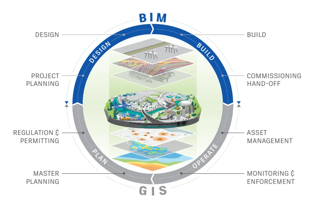
In the rapidly evolving world of urban planning and infrastructure development, the integration of Building Information Modelling (BIM) and Geographic Information Systems (GIS) has become a cornerstone for creating digital twins of cities. These digital twins are virtual replicas of physical urban environments, enabling stakeholders to simulate, analyze, and optimize various aspects of city planning and management. However, the seamless integration of BIM and GIS data has been a persistent challenge, often hindering the full potential of these technologies.
Enter P. Mohammed, a researcher from the School of Surveying and Construction Innovation at Technological University Dublin, Ireland. Mohammed has proposed a groundbreaking conceptual framework aimed at standardizing the integration of BIM and GIS data. Published in ‘The International Archives of the Photogrammetry, Remote Sensing and Spatial Information Sciences’—which, in English, translates to ‘The International Archives of Photogrammetry, Remote Sensing, and Spatial Information Sciences’—this research offers a structured approach to addressing the myriad challenges associated with BIM-GIS integration.
The framework, dubbed the Levels of Integration (LoInt), is designed to categorize and address integration challenges progressively. It consists of four levels, ranging from LoInt100 to LoInt400, each corresponding to a different degree of interoperability between BIM and GIS systems. “The idea is to provide a clear, step-by-step guideline that can be used as a decision-making support system for applications requiring BIM-GIS data integration,” Mohammed explains.
For the energy sector, the implications are significant. The ability to seamlessly integrate BIM and GIS data can revolutionize the way energy infrastructure is planned, designed, and managed. For instance, digital twins of cities can be used to optimize the placement of renewable energy sources, such as solar panels and wind turbines, by analyzing geographical data alongside building information. This can lead to more efficient energy distribution and reduced costs.
Moreover, the integration of BIM and GIS data can enhance the maintenance and operation of energy infrastructure. By creating a comprehensive digital twin, energy companies can simulate various scenarios, identify potential issues, and implement preventive measures before they become critical. This proactive approach can significantly reduce downtime and improve the overall reliability of energy systems.
The commercial impact of this research is substantial. As cities around the world strive to become smarter and more sustainable, the demand for integrated BIM-GIS solutions is expected to grow. Companies that adopt this framework can gain a competitive edge by offering more efficient and effective services to their clients.
Mohammed’s research is a significant step forward in the field of urban digital twins. By providing a standardized approach to BIM-GIS integration, it paves the way for more innovative and efficient solutions in city planning and energy management. As the world continues to urbanize, the need for such integrated systems will only increase, making this research all the more relevant and impactful.
In the words of Mohammed, “This framework is not just about addressing challenges; it’s about creating opportunities for innovation and improvement in the way we plan and manage our urban environments.” With the energy sector poised to benefit greatly from these advancements, the future looks bright for integrated BIM-GIS solutions.