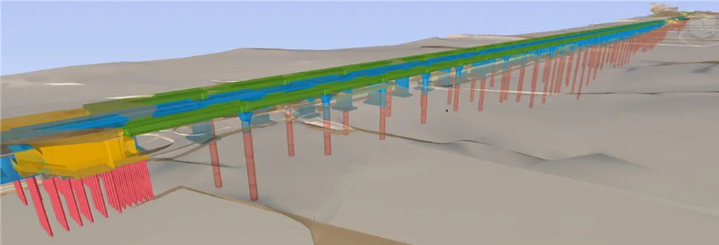
In the bustling, ever-evolving world of construction and urban development, a groundbreaking study led by Han-Saem Kim from Dongguk University in Seoul, South Korea, is set to revolutionize how we approach geotechnical challenges in soft ground areas. Published in the journal ‘Developments in the Built Environment’ (which translates to ‘Built Environment Progress’), this research integrates advanced 3D geotechnical characterization with Geo-BIM (Geotechnical Building Information Modeling) to assess and mitigate geohazards, offering significant implications for the energy sector and smart city development.
Kim and his team have developed a decision-making framework that leverages high-density geotechnical survey data and geostatistical modeling to create a detailed 3D ground model. This model, with a resolution of 5m x 5m x 1m, enables regional site characterization and prediction of consolidation-induced settlement and site response analysis. The result? Comprehensive 2D/3D hazard zonation maps that support early design and risk mitigation strategies.
“The integration of geotechnical data with Geo-BIM allows us to visualize subsurface conditions and make informed engineering decisions,” Kim explains. This capability is particularly crucial for the energy sector, where infrastructure often spans vast, geologically complex areas. By identifying potential geohazards such as settlement, liquefaction, and seismic amplification, this framework can guide the design of embankments, ground improvement plans, and overall risk mitigation strategies.
The study’s case study in a reclaimed coastal area demonstrates the practical application of this framework. By tailoring preliminary and detailed surveys, remote sensing, and monitoring strategies to vulnerable zones, the team was able to create a high-resolution 3D ground model. This model not only aids in visualizing subsurface conditions but also informs engineering decisions, promoting data-driven decision-making in smart city development and digital construction.
The implications of this research are far-reaching. As cities grow and infrastructure expands, the need for accurate, detailed geotechnical data becomes ever more critical. By facilitating geotechnical digitalization, this framework supports the development of safer, more resilient urban environments. For the energy sector, it offers a tool to enhance the reliability and safety of infrastructure, ultimately contributing to more sustainable and efficient energy production and distribution.
As we look to the future, the integration of advanced geotechnical characterization with Geo-BIM holds the potential to transform how we approach construction and urban planning. By embracing these technologies, we can build smarter, safer cities and infrastructure, paving the way for a more resilient and sustainable future.